Back غلاستونبوري (كونيتيكت) Arabic Гластонбери (Коннектикут) CE Glastonbury (lungsod sa Tinipong Bansa) CEB Glastonbury, Connecticut Welsh Glastonbury (Connecticut) German Glastonbury (Connecticut) Spanish Glastonbury (Connecticut) Basque گلستونبری، کنتیکت Persian Glastonbury (Connecticut) French Glastonbury, Connecticut HT
Glastonbury, Connecticut | |
|---|---|
Town | |
| Town of Glastonbury | |
 First Church of Christ | |
| Coordinates: 41°41′13″N 72°32′41″W / 41.68694°N 72.54472°W | |
| Country | |
| U.S. state | |
| County | Hartford |
| Region | Capitol Region |
| Settled | 1636 |
| Incorporated | 1693 |
| Communities | Glastonbury Addison Buckingham East Glastonbury Hopewell South Glastonbury Welles Village |
| Government | |
| • Type | Council-manager |
| • Town council [1] | Thomas Gullotta, Chairman Lawrence Niland, Vice Chairman Deborah Carroll, Majority Leader Mary LaChance Jennifer Wang Jacob McChesney Kurt Cavanaugh Whit Osgood John Cavanna |
| • Town Manager | Jonathan Luiz |
| Area | |
• Total | 52.2 sq mi (135.2 km2) |
| • Land | 51.3 sq mi (132.8 km2) |
| • Water | 0.9 sq mi (2.4 km2) |
| Elevation | 417 ft (127 m) |
| Population (2020)[2] | |
• Total | 35,159 |
| • Density | 670/sq mi (260/km2) |
| Time zone | UTC-5 (Eastern) |
| • Summer (DST) | UTC-4 (Eastern) |
| ZIP Codes | 06025, 06033, 06073 |
| Area code(s) | 860/959 |
| FIPS code | 09-31240 |
| GNIS feature ID | 0213432 |
| Major Highways | |
| Website | www |
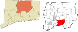
Glastonbury (/ˈɡlæstənbɛri/ GLAST-ən-berr-ee) is a town in the Capitol Planning Region, Connecticut, United States, formally founded in 1693 and first settled in 1636. It was named after Glastonbury in Somerset, England.[3] Glastonbury is on the banks of the Connecticut River, 7 miles (11 km) southeast of Hartford. The town center is defined by the U.S. Census Bureau as a census-designated place (CDP). The population was 35,159 at the 2020 census.[2]
- ^ "Town Leadership / Town Council | Glastonbury, CT".
- ^ a b "Census - Geography Profile: Glastonbury town, Hartford County, Connecticut". United States Census Bureau. Retrieved December 16, 2021.
- ^ The Connecticut Magazine: An Illustrated Monthly. Connecticut Magazine Company. 1903. p. 332.


